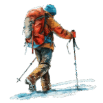
Enjoy an exciting journey through the captivating trails of the Tilicho Lake Trek, surrounded by towering Himalayan peaks, rugged landscapes, and the rich cultural heritage of the Annapurna region. Trek to the pristine turquoise waters of Tilicho Lake — one of the highest lakes in the world — set against a breathtaking mountain backdrop. This remarkable adventure offers a perfect blend of natural wonder, spiritual serenity, and unforgettable alpine scenery in the heart of the Himalayas.
12 Days
Moderate
10 Quest
4,919 m
14 Days
Moderate
10 Quest
4,919 m
The Tilicho Lake Trek is one of the most captivating and adventurous high-altitude journeys in the Annapurna region of Nepal, taking trekkers to the serene and sacred Tilicho Lake (4,919 m / 16,138 ft)—widely recognized as one of the highest lakes in the world. This trek is often considered an extension of the Annapurna Circuit, branching off from the trail in Manang and rewarding travelers with some of the most stunning alpine scenery in the Himalayas. Known for its rugged beauty, spiritual significance, and sense of remoteness, the trek has become a dream adventure for trekkers seeking something beyond the classic trails.
The journey begins in the lowlands of the Annapurna region, where the landscapes are characterized by lush forests, terraced fields, cascading rivers, and traditional villages. As the trek ascends, the terrain gradually shifts into alpine meadows, rocky cliffs, and eventually the barren, windswept landscapes of Manang, offering a stark contrast to the greenery of the lower altitudes. Trekkers are surrounded by dramatic Himalayan giants such as Tilicho Peak (7,134 m), Annapurna II (7,937 m), Gangapurna (7,455 m), and Nilgiri (7,061 m), creating an awe-inspiring backdrop at every step of the journey.
The cultural experience is just as rich as the natural scenery. The trek passes through Gurung, Thakali, and Manangi villages, where centuries-old Tibetan-Buddhist traditions are still alive. Monasteries, chortens, prayer walls, and fluttering prayer flags add a spiritual ambiance to the trail, reminding trekkers that this region is not just a natural paradise but also a living cultural heritage site. The locals’ warmth, hospitality, and simple way of life make the trek deeply meaningful beyond its physical challenges.
The highlight, of course, is reaching Tilicho Lake, a breathtaking turquoise alpine lake that rests quietly beneath towering cliffs and glaciers. Its sheer size and pristine beauty leave trekkers in awe. Tilicho Lake is not only a natural wonder but also holds deep spiritual importance. Hindus believe it is mentioned in the ancient epic Ramayana, where it is described as the lake formed from the tears of a sorrowful deity. For Buddhists, it is a site of peace and meditation. Standing at the lake’s edge, surrounded by snowcapped peaks and silence, many trekkers describe the experience as profoundly spiritual and humbling.
Reaching Tilicho Lake is challenging but not technical. The trail involves steep ascents, narrow rocky paths, and exposure to high altitude, with the risk of altitude sickness being the biggest concern. The journey to Tilicho Lake from Manang usually takes 3–4 days as a side trip, but it can be seamlessly combined with the Thorong La Pass (5,416 m) crossing or the longer Annapurna Circuit Trek. Because of its difficulty and remoteness, the trek is recommended for trekkers who are reasonably fit and have some high-altitude experience, though determined beginners with proper preparation can also accomplish it.
In addition to the physical and cultural aspects, the trek provides a remarkable ecological journey. The lower trails are home to rich biodiversity, including rhododendron forests, Himalayan langurs, and a variety of bird species, while the higher regions become more barren, offering a glimpse into the unique flora and fauna that survive in such harsh conditions.
In essence, the Tilicho Lake Trek is a journey of contrasts—lush valleys and barren cliffs, cultural vibrancy and remote solitude, physical challenge and spiritual peace. It is not just about reaching one of the world’s highest lakes but about experiencing the full spectrum of nature, culture, and adventure that Nepal’s Annapurna region has to offer. For trekkers seeking a unique, challenging, and deeply rewarding Himalayan adventure, Tilicho Lake stands as a destination unlike any other.
Elevation: 1400 m → 600 m
Distance: 135 km
Duration: 7–9 hours
Overnight Stay: Arughat
The Tsum Valley Trek begins with an early morning drive from Kathmandu (1,400m) to Arughat (600m), which is the main gateway to the Manaslu and Tsum regions. The drive typically takes 7–9 hours, depending on road conditions, and follows the winding highways through the hilly landscapes of central Nepal.
As you leave the bustling streets of Kathmandu, the journey gradually transitions into serene rural landscapes. You will pass through terraced farmlands, small villages, and winding river valleys, offering a glimpse into the everyday life of local Nepali communities. The route follows the Trishuli and Budhi Gandaki River corridors, providing scenic views of the river gorges, hillsides, and distant Himalayan peaks.
The road journey can be bumpy at times, as some sections are still under development, but it offers a sense of adventure and anticipation as you approach the remote highlands. Along the way, you may see traders, livestock herders, and children walking to school, providing an authentic look at rural Nepalese life.
Arriving in Arughat, trekkers can enjoy a comfortable stay in local lodges or guesthouses. This town serves as the last stop for supplies, refreshments, and preparations before heading into the Tsum Valley. The drive from Kathmandu to Arughat not only provides a scenic introduction to the region but also allows trekkers to gradually adjust to the tranquil mountain environment they will experience on the trek.
Elevation: 600 m → 1180 m
Distance:15–17 km
Duration: 6–7 hours
Overnight Stay: Singa
The trek from Arughat (600m) to Singa (1,180m) marks the beginning of your journey into the lush and culturally rich Budhi Gandaki valley. This stage is usually the first day of trekking, covering approximately 15–17 km and taking around 6–7 hours, depending on your pace.
Leaving Arughat, the trail follows the Budhi Gandaki River, winding through terraced farmlands, small hamlets, and dense forests of sal, pine, and rhododendron. The path gradually gains elevation, providing a gentle introduction to trekking while offering beautiful views of the surrounding hills and the river valley below.
Along the route, you will pass several small villages and suspension bridges, giving you the chance to observe local Nepali village life. Farmers can often be seen tending their fields, and children playing along the trails add charm to the journey. The path is well-marked, but trekkers should be cautious at river crossings, especially during the monsoon season.
Singa is a small village situated on a hillside overlooking the river valley. It offers a few basic teahouses and lodges, providing meals and overnight accommodation. This village serves as a peaceful first stop, allowing trekkers to relax and enjoy the serene environment before heading deeper into the remote Tsum Valley.
Elevation: 1180 m → 1920 m
Distance: 12–14 km
Duration: 5–6 hours
Overnight Stay: Chumling
The trek from Singa (1,180m) to Chumling (1,920m) is the first day venturing into the Tsum Valley proper, offering a mix of scenic landscapes, traditional villages, and gradual elevation gain. This stage is approximately 12–14 km long and typically takes 5–6 hours, depending on your pace and rest breaks.
Leaving Singa, the trail follows the Budhi Gandaki River, crossing several suspension bridges and walking through terraced fields where locals cultivate maize, millet, and potatoes. The path gradually ascends, taking trekkers through lush subtropical forests of bamboo, pine, and rhododendron. Along the way, you’ll notice small stone-built villages perched on the hillsides, reflecting the traditional Gurung and Tibetan-influenced architecture of the region.
As you approach Chumling, the landscape becomes more remote and mountainous, with stunning views of the Ganesh Himal and surrounding peaks emerging in the distance. The village of Chumling is a small, peaceful settlement with a few family-run teahouses offering simple accommodations and meals. This is a good place to acclimatize gently and experience the local lifestyle.
Chumling is also known for its traditional Tibetan Buddhist culture, with mani walls, prayer flags, and small monasteries scattered throughout the village. Interacting with the locals provides a glimpse into their centuries-old customs, festivals, and spiritual practices.
Elevation: 1920 m → 2400 m
Distance: 10–12 km
Duration: 5–6 hours
Overnight Stay: Chhokang Paro
The trek from Chumling (1,920m) to Chhokang Paro (2,400m) is a scenic and culturally rich section, marking further entry into the Tsum Valley’s highland landscapes. This stage covers approximately 10–12 km and usually takes 5–6 hours, depending on pace and breaks.
From Chumling, the trail begins with a gradual ascent, winding through terraced fields, small forests, and riverside paths. You will pass traditional stone and mud-brick houses, giving trekkers a closer look at the Tsumpa way of life, including farming, herding yaks, and daily village activities. Mani walls, prayer flags, and small stupas dot the path, offering a glimpse of the region’s deep-rooted Tibetan Buddhist culture.
The trail offers panoramic views of the surrounding hills and snow-capped peaks, including Ganesh Himal and other lesser-known summits. The terrain alternates between forested sections and open hillsides, providing opportunities to photograph the natural scenery and observe wildlife such as Himalayan birds, langurs, and occasionally red pandas in higher forested areas.
Chhokang Paro is a quaint village perched on a hillside, with a few basic teahouses providing meals and overnight accommodation. This village is slightly more remote than Chumling, giving trekkers a sense of isolation and tranquility. Staying here allows for gradual acclimatization, as the altitude begins to rise steadily in the upper Tsum Valley.
Elevation: 2400 m → 2650 m
Distance: 12–14 km
Duration: 5–6 hours
Overnight Stay: Nile
The trek from Chhokang Paro (2,400m) to Nile (2,650m) marks a significant step deeper into the high-altitude region of the Tsum Valley. Covering approximately 12–14 km, this stage typically takes 5–6 hours of trekking, featuring gentle ascents and gradually steeper sections as you approach the higher settlements.
Leaving Chhokang Paro, the trail passes through dense forests of pine, oak, and rhododendron, interspersed with small streams and terraced fields. You’ll encounter traditional Tsumpa villages along the way, each adorned with mani walls, prayer flags, and chortens that reflect the region’s Tibetan Buddhist culture. Villagers continue their daily routines of farming and herding yaks, offering trekkers a glimpse into life that has remained largely unchanged for centuries.
The scenery opens up as you approach Nile, with panoramic views of the Ganesh Himal range and the Budhi Gandaki River valley below. The trail includes crossing suspension bridges and narrow mountain paths that add a sense of adventure while traversing this remote region.
Nile is a small, welcoming village with family-run teahouses, providing basic meals and lodging. The village is culturally rich, and trekkers often have the opportunity to visit local monasteries and sacred sites, interacting with monks and villagers to learn more about their traditions and spiritual practices. This overnight stop also serves as a good acclimatization point, as the altitude steadily increases in the Tsum Valley.
Elevation: 2650 m → 3700 m
Distance: 12–14 km
Duration: 6–7 hours
Overnight Stay: Mu Gompa
The trek from Chhokang Paro (2,400m) to Nile (2,650m) marks a significant step deeper into the high-altitude region of the Tsum Valley. Covering approximately 12–14 km, this stage typically takes 5–6 hours of trekking, featuring gentle ascents and gradually steeper sections as you approach the higher settlements.
Leaving Chhokang Paro, the trail passes through dense forests of pine, oak, and rhododendron, interspersed with small streams and terraced fields. You’ll encounter traditional Tsumpa villages along the way, each adorned with mani walls, prayer flags, and chortens that reflect the region’s Tibetan Buddhist culture. Villagers continue their daily routines of farming and herding yaks, offering trekkers a glimpse into life that has remained largely unchanged for centuries.
The scenery opens up as you approach Nile, with panoramic views of the Ganesh Himal range and the Budhi Gandaki River valley below. The trail includes crossing suspension bridges and narrow mountain paths that add a sense of adventure while traversing this remote region.
Nile is a small, welcoming village with family-run teahouses, providing basic meals and lodging. The village is culturally rich, and trekkers often have the opportunity to visit local monasteries and sacred sites, interacting with monks and villagers to learn more about their traditions and spiritual practices. This overnight stop also serves as a good acclimatization point, as the altitude steadily increases in the Tsum Valley.
Elevation: 3700 m
Activities: Short acclimatization hikes, monastery visit, meditation, photography
Overnight Stay: Mu Gompa
After reaching Mu Gompa (3,700m), an acclimatization day is recommended to help your body adjust to the higher altitude and reduce the risk of Altitude Sickness (AMS). This day provides an opportunity to rest, explore the surrounding area, and immerse yourself in the spiritual and cultural environment of one of Tsum Valley’s most sacred sites.
During this day, trekkers can take short hikes around Mu Gompa, such as walking to nearby ridges or small alpine meadows, which typically range between 3,800–4,000m. These gentle hikes help increase red blood cell production, improving oxygen efficiency and preparing you for the upcoming higher-altitude stages. The walks also offer stunning panoramic views of the surrounding peaks, including Ngadi Chuli, Ganesh Himal, and Himlung Himal.
Mu Gompa itself is a remote Buddhist monastery, home to monks who have maintained centuries-old traditions. Trekkers can explore the monastery complex, observe prayers and rituals, and learn about the Tsumpa people’s spiritual practices. The serene environment provides a perfect setting for meditation, reflection, and photography.
Meals and accommodation are provided in the monastery or nearby teahouses, with simple, nourishing local cuisine to support energy levels and recovery. Hydration is emphasized during the acclimatization day, as the body requires more fluids at higher altitudes.
Elevation: 3700 m → 2650 m
Distance: 12–14 km
Duration: 5–6 hours
Overnight Stay: Nile
After spending time at Mu Gompa (3,700m) and enjoying acclimatization and the spiritual atmosphere, trekkers begin the return journey down to Nile (2,650m). This stage covers approximately 12–14 km and typically takes 5–6 hours, following a mostly downhill route.
Leaving Mu Gompa, the trail descends through alpine meadows, yak pastures, and scattered forests of pine and fir. The descent allows trekkers to enjoy panoramic views of the Himalayan peaks one last time before leaving the higher altitudes of the valley. Along the way, you’ll notice the traditional Tsumpa settlements, prayer flags, and mani walls, providing another opportunity to appreciate the culture and spirituality of the region.
The trail is well-marked but includes some rocky sections and small river crossings, so careful footing is advised. The gentle descent also gives trekkers a chance to reflect on their journey, take photographs, and observe local life in the villages they pass.
Arriving back in Nile (2,650m), trekkers are welcomed by the familiar village atmosphere, with family-run teahouses providing simple meals and comfortable lodging. This overnight stop allows the body to recover from the higher altitudes of Mu Gompa and prepares trekkers for the remaining stages of the trek back to the trailhead.
Elevation: 2650 m → 1920 m
Distance: 12–14 km
Duration: 5–6 hours
Overnight Stay: Chumling
After descending from Mu Gompa and spending a night in Nile (2,650m), trekkers continue their journey back toward the lower reaches of the Tsum Valley, heading to Chumling (1,920m). This stage covers approximately 12–14 km and usually takes 5–6 hours, featuring a mostly downhill route with gentle sections through forests and villages.
Leaving Nile, the trail passes through dense pine and oak forests, terraced fields, and yak pastures. Trekkers will again notice the traditional Tsumpa villages, mani walls, and prayer flags, giving a sense of continuity with the culture experienced on the ascent. The river valley below provides scenic views, and occasional river crossings and suspension bridges add a sense of adventure to the descent.
The descent is gradual but long, allowing trekkers to enjoy the natural beauty, take photographs, and observe the local lifestyle. Walking downhill can be surprisingly tiring on the knees, so proper pacing and short breaks are recommended.
Arriving back in Chumling (1,920m), trekkers are welcomed by the familiar village atmosphere, with family-run teahouses providing simple meals and overnight accommodation. This stop allows trekkers to rest, enjoy the peaceful surroundings, and reflect on the higher-altitude experiences from Mu Gompa and the Tsum Valley.
Elevation: 1920 m → 1180 m
Distance: 12–14 km
Duration: 5–6 hours
Overnight Stay: Singa
After leaving Chumling (1,920m), trekkers descend further along the Budhi Gandaki River valley toward Singa (1,180m). This stage covers approximately 12–14 km and usually takes 5–6 hours, featuring a mostly downhill trail with gentle and moderate sections.
The trail passes through forested areas of pine, oak, and rhododendron, interspersed with terraced farmland and small villages. Trekkers will again see traditional stone and mud houses, mani walls, prayer flags, and glimpses of local life, including farming and livestock herding. The descent offers plenty of opportunities for photography and to enjoy the natural beauty of the Tsum Valley one last time.
Walking downhill requires steady pacing to avoid fatigue on the knees, but the trail’s gradual descent makes it a relatively comfortable stage. Suspension bridges and river crossings add minor challenges and a sense of adventure.
Arriving in Singa (1,180m), trekkers can rest at local teahouses, enjoy a warm meal, and prepare for the final stage of the trek back to the trailhead in Arughat. The village provides a welcoming atmosphere and a chance to reflect on the cultural and spiritual experiences of the Tsum Valley.
Elevation: 1180 m → 600 m
Distance: 15–17 km
Duration: 6–7 hours
Overnight Stay: Arughat
The trek from Singa (1,180m) back to Arughat (600m) marks the conclusion of your journey through the remote and culturally rich Tsum Valley. This stage is approximately 15–17 km long and typically takes 6–7 hours, featuring a mostly downhill route with gentle sections through the lush Budhi Gandaki River valley.
Leaving Singa, the trail gradually descends through terrestrial farmland, small hamlets, and dense forests of pine, oak, and bamboo. Trekkers will notice villagers tending their fields, children walking to school, and livestock grazing, offering a glimpse of everyday life in rural Nepal. Suspension bridges and small river crossings add minor adventure to this final leg of the trek.
As you approach Arughat, the scenery transitions back to the subtropical lowlands, with terraced fields and riverside villages lining the trail. The descent is comfortable and allows trekkers to reflect on their experiences in the high Himalayas, the spiritual encounters at Mu Gompa, and the cultural richness of the Tsum Valley.
Arriving in Arughat (600m), trekkers can rest at local lodges or guesthouses and prepare for the drive back to Kathmandu, concluding the trek. This final stage offers a satisfying end to the journey, as trekkers reconnect with the lower-altitude landscapes while carrying memories of the valley’s serenity and tradition.
Elevation: 600 m → 1400 m
Distance: 135 km
Duration: 7–9 hours
End of Trek: Kathmandu
After completing the return trek to Arughat (600m), the journey concludes with a scenic drive back to Kathmandu (1,400m). The drive typically takes 7–9 hours, depending on road and traffic conditions, and offers a relaxing end to your trekking adventure.
The route winds through the hilly landscapes of central Nepal, passing terraced farmlands, small villages, and the Budhi Gandaki River valley. As you ascend from Arughat toward Kathmandu, the scenery gradually shifts from the subtropical lowlands to the greener hills and forests surrounding the Kathmandu Valley. Along the way, you’ll get glimpses of rural Nepali life, including farmers tending fields, children walking to school, and traditional village settlements.
The drive is an opportunity to reflect on your Tsum Valley journey, the cultural and spiritual experiences in remote villages, and the breathtaking landscapes of the valley. Upon arrival in Kathmandu, trekkers can enjoy comfortable accommodations, a warm meal, and a chance to relax after days of trekking through one of Nepal’s most pristine and sacred regions.
Your package includes transportation fare covering the road transfer from Kathmandu to Besisahar, the starting point of the Tilicho Lake Trek, and the return journey from Besisahar/Pokhara to Kathmandu. This service ensures a comfortable and scenic journey through the diverse landscapes of Nepal, including terraced hills, rivers, and rural villages. Travelers can enjoy views of the Himalayan foothills, Marshyangdi River Valley, traditional settlements, and winding mountain roads while safely reaching the starting points and endpoints of the trek, allowing for a smooth and convenient trekking experience
Entry to the Annapurna Conservation Area is mandatory for all trekkers. This fee ensures legal access to the region and supports conservation efforts and local communities.
Full board service is included during the trek, covering breakfast, lunch, and dinner. Accommodation is provided in teahouses or lodges along the route, offering clean, safe, and basic facilities.
Complimentary tea and coffee are available during meals and rest stops to keep you refreshed and energized throughout the trek.
Safe drinking water is arranged throughout the trek, either boiled, filtered, or purchased at teahouses.
An experienced English-speaking trekking guide accompanies you throughout the trek, providing expert guidance, cultural insights, and support for safety and acclimatization.
One porter for every two trekkers is provided to carry luggage, with a maximum of 18 kg per porter. This ensures your load is manageable and trekking is more comfortable.
The wages for your guide and porter throughout the trek are included, ensuring their full-time support and assistance.
Insurance coverage is provided for both your guide and porter, safeguarding them against accidents and emergencies during the trek.
The wages for your porter, who will help carry your luggage and ease your trekking experience, are included.
A comprehensive first aid kit is provided throughout the trek to handle minor injuries or illnesses promptly.
Flights to and from Nepal are not included in the package. Trekkers are responsible for arranging their own international travel.
The cost of staying in hotels before or after the trek in Kathmandu and Pokhara is not included in the package. Travelers are expected to arrange and pay for their own accommodations in these cities.
Meals before the trek in Kathmandu and after the trek in Pokhara are not included. Travelers are expected to pay for their own food in the cities.
Expenditures such as souvenirs, alcoholic beverages, bottled or canned drinks, snacks, laundry services, internet usage, and telephone calls are considered personal and are not covered by the package.
The package does not include travel insurance. All travelers are strongly advised to obtain comprehensive travel insurance that covers medical emergencies, trip cancellations or interruptions, lost or stolen luggage, and emergency evacuations, including high-altitude rescue
Tips for guides, porters, drivers, and other service staff are not included in the package. While tipping is not mandatory, it is customary and appreciated for good service, and the amount is left to the discretion of the traveler.
Any activities, tours, excursions, or services that are not explicitly mentioned in the itinerary, such as helicopter flights, sightseeing tours, or premium lodging upgrades, will incur additional costs.
Charges for hot showers, Wi-Fi, and other optional services at teahouses or lodges are not included.
Costs related to medical treatment, medicines, or emergency evacuations due to illness, injury, altitude sickness, or other unforeseen circumstances are not covered. These costs should be either insured under a travel insurance policy or paid out of pocket.
Airfare for domestic flights included in the trek package (e.g., Kathmandu–Lukla–Kathmandu) is usually included, but any extra flights, changes, or delays due to weather or personal reasons must be paid separately by the traveler.
Specialized trekking gear such as sleeping bags, down jackets, trekking poles, gaiters, or personal climbing equipment is not included and should be arranged individually unless rented through the trekking company.
For a comfortable and successful trek, having the right clothing, gear, and equipment is essential. One porter will be assigned for every two trekkers, with a maximum carrying capacity of 18 kg. This means each trekker is allowed to bring up to 9 kg of personal luggage.
As the porter will carry gear for two people, we recommend coordinating with a trekking partner and packing both sets of gear in a single duffel bag of at least 60 liters. In addition, each trekker should carry a personal daypack (20–30 liters) for essentials such as valuables, snacks, water, and important documents.
While personal preferences may vary, we suggest bringing only the necessary clothing and accessories for the trek. Any extra luggage you don’t need on the trail can be safely stored at your hotel or at the Discovery World Trekking office free of charge during the trek.
Tilicho Lake is located in the Annapurna region of Nepal, at an altitude of 4,919 m.
The trek typically takes 10–12 days if combined with the Annapurna Circuit.
The distance ranges from 120–135 km, depending on the chosen route.
The highest point is Thorong La Pass at 5,416 m, if included in the itinerary.
It’s moderate to challenging and recommended for trekkers with prior trekking experience and good fitness.
Yes, but there may be heavy snow, especially near Tilicho Lake and Thorong La, requiring proper gear.
Temperatures range from 10–20°C in lower valleys to -10 to -5°C at high altitudes.
Monsoon season (June–August) brings heavy rain, landslides, and slippery trails, so it’s not recommended.
During spring and autumn, snow gear is usually not required; in winter or post-monsoon, trekking poles and crampons may be necessary.
The risk increases above 3,500 m, especially near Manang, Tilicho Base Camp, and Thorong La Pass.
Take rest/acclimatization days, stay hydrated, and follow the “climb high, sleep low” principle.
Oxygen is generally not required, but some trekkers carry a portable oxygen kit for safety.
Basic health posts are in Manang and Chame, but remote areas have limited facilities.
Yes, high-altitude trekking insurance covering helicopter evacuation is strongly recommended.
Accommodations include tea houses, lodges, and guesthouses in villages like Syange, Chame, Pisang, Manang, and Tilicho Base Camp.
Yes, simple meals like Dal Bhat, noodles, soups, and bread are available in tea houses.
Vegetarian meals are widely available along the trail.
No, the trek is mostly supported by tea house lodges, so camping is optional.
Yes, basic teahouses are available in Manang, Yak Kharka, Thorong Phedi, and other settlements.
Basic lodges or camping options, limited food, and water—trekkers often carry snacks.
Yes, warm sleeping bags are essential, especially for high-altitude nights.
Limited—mainly in Manang and some larger lodges; most high-altitude stops have cold water only.
Some lodges have solar power for charging devices; not guaranteed everywhere.
Warm clothing, trekking boots, trekking poles, down jacket, gloves, hat, sunglasses, sunscreen, water bottles.
Highly recommended for steep ascents/descents and rocky terrain.
Not generally required unless trekking in snow during winter.
Optional; most trekkers use teahouses, but tents are needed for camping trips.
Yes, high-altitude streams may need treatment before drinking.
Yes, Annapurna Conservation Area Permit (ACAP) and Trekkers’ Information Management System (TIMS) card are required.
Yes, ACAP and TIMS can be obtained in Kathmandu or Pokhara before the trek.
Yes, but a local guide ensures safety, proper acclimatization, and local knowledge.
Yes, travel and high-altitude trekking insurance is strongly recommended.
Exclusive to your group – a tailor-made adventure with no unfamiliar faces
Design your adventure to match your pace and priorities.
Enjoy dedicated support from seasoned trekking professionals
Adapted altitude support, always on call
Start when you want, move how you like
Designed for couples, close friends, and families


Get the latest news, offers and inspiring travel stories straight to your inbox.
Sat:
Closed
Sun-Fri:
9:30-6:00
HGI Nepal is a trusted leader with decades of experience in crafting quality travel packages across Nepal’s diverse landscapes.